Summer
SURVEY
We’re delighted to have you here on holiday
As part of our GSTC sustainability efforts, we are working to make our region even more livable and responsible for both guests and local residents.
Your opinion matters to us: What did you particularly enjoy during your stay? Where can we improve?
Please take about 10 minutes to share your feedback.
To the survey
Holiday planning
Dachmarke Suedtirol
Holiday planning
telephone-white Call us email-white Write us whatsapp-white WhatsApp arrow-white 360° View
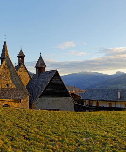
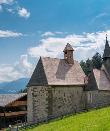
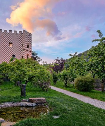
Dreikirchen at sunset

Mystic

Bad Dreikirchen

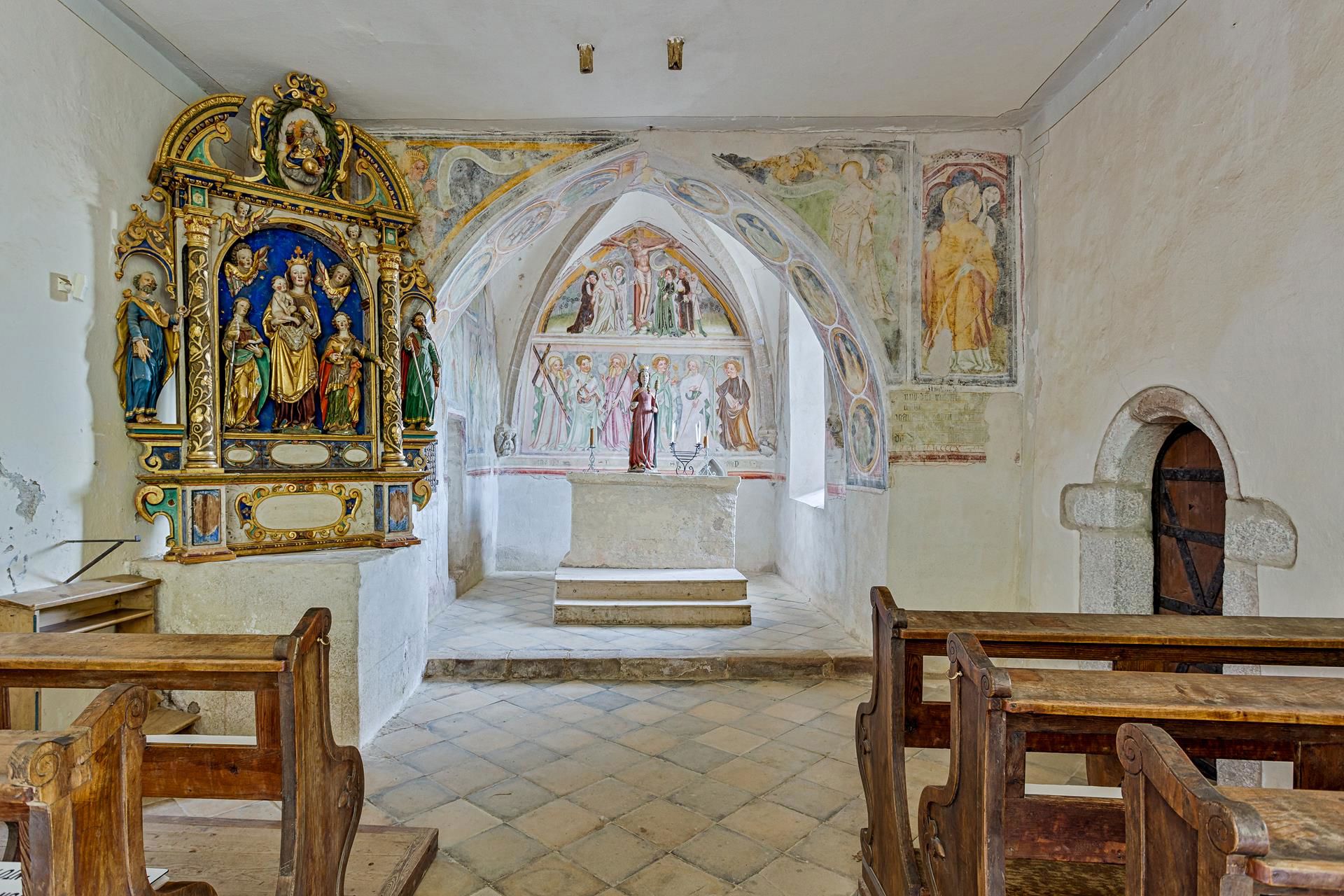
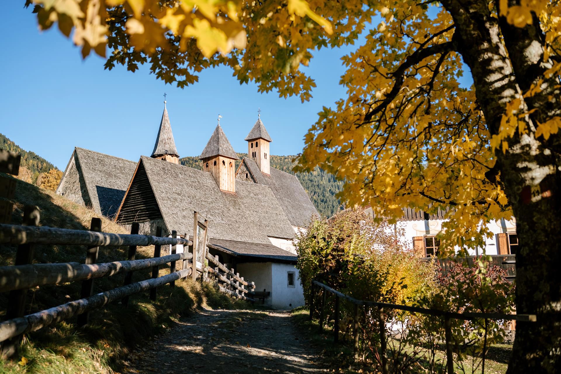
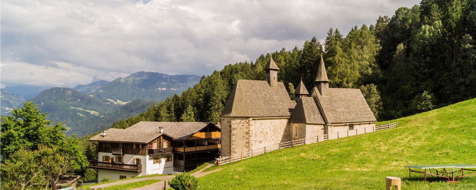
Three small churches, church of Saint Gertraud, Saint Nikolaus and Saint Magdalena, built in the 12th and 15th century in an incredibly beautiful location with a fantastic view over the Eisack Valley. Visitors will be surprised by the high level of artistic skill of the late-Gothic frescoes.

Dreikirchen can only be reached on foot along beautiful hiking trails for young and old.
A look inside the churches is always worth it!
Good to know...
Barbian Waterfalls & Tree Churches (Dreikirchen)
Start and finish: village centre of Barbian
Time: 4:00 hours
Distance: 8.6km
Difference in altitude: 560m
Max. altitude: 1,353m

Route
The trail to the Barbian waterfalls starts in the village centre of Barbian (refreshment facilities). Take the waterfall trail first to the lower and then to the upper waterfall. Take trails 34 and 27 then to Briol (refreshment facilities). Continue to Bad Dreikirchen (refreshment facilities) on trail 4. To return to Barbian take trail 6 first of all. It then branches off into trail 3. Back to the starting point on the Dorfstraße.
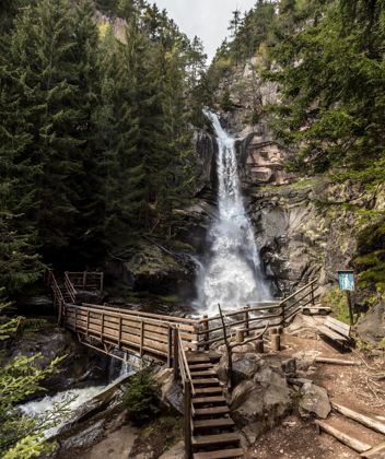
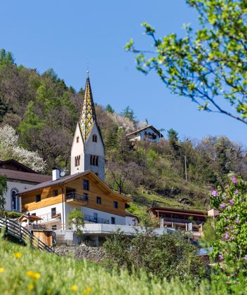
The spectacular Barbian waterfalls are of course the attraction of this hike. They cascade down a total of 200 metres to the depths. Along the trail however there are also other things to see, for example, the leaning steeple of the church of Barbian.
Those interested in architecture will have a lot of pleasure with the Gasthof (inn) Briol. It is a fine example of Neue Sachlichkeit (New Objectivity) in the heart of the Alps. The artist Hubert Lanzinger has created a total work of art, in which it is possible to live and eat, out of a former shelter.
Dreikirchen should also be mentioned. It is an especially interesting architectural ensemble, constructed on the site of an ancient spring sanctuary.
Info Dreikirchen
If you want to take a look inside the churches, please ask for the key from the nearby Messner restaurant.
Guided tours are available on request, Tel. 0471 650 059
Hiking trail recommended route Hiking trail  · South Tyrol Open

Tour 2 to the cascate and Trechiese/Dreikirchen

Responsible for this content
Klausen, Barbian, Villanders, Feldthurns
  • Waterfal
    Waterfal
    Photo: Wolfgang Gafriller, Klausen, Barbian, Villanders, Feldthurns
Map / Tour 2 to the cascate and Trechiese/Dreikirchen

Selected alternatives for you
    Varied circular hike from Barbian via the waterfalls and Katzenleiter to Briol and Bad Dreikirchen. Sure-footedness and sturdy footwear are required.
    Open
    moderate
    Distance 8.8 km
    3:30 h
    565 m
    565 m
    1,353 m
    832 m

    This varied circular hike leads from the village centre of Barbian to both Barbian waterfalls. It then continues via the Katzenleiter, Kasserol and Stangen to Briol and Bad Dreikirchen. Along the route, you can enjoy impressive waterfalls, shaded woodland trails and beautiful views over the rural landscape surrounding Barbian.

    Several steep and narrow sections, particularly near the Upper Waterfall and along the Katzenleiter, require sure-footedness and sturdy footwear. Stones, steps and roots can become very slippery in wet conditions. This moderately difficult hike is therefore suitable for experienced hikers with a good level of fitness. Refreshment stops are available in Briol, Bad Dreikirchen and the village centre of Barbian.

    Responsible for this content
    Klausen, Barbian, Villanders, Feldthurns 
    Difficulty
    moderate
    Overall difficulty
    moderate

    Derived from the technical difficulty and the stamina requirements.

    Experience
    Landscape
    Highest point
    1,353 m
    Lowest point
    832 m
    Best time of year
    Jan
    Feb
    Mar
    Apr
    May
    Jun
    Jul
    Aug
    Sep
    Oct
    Nov
    Dec

    Track types

    Show elevation profile

    Roadbook

    The circular hike starts in the village square of Barbian. From there, follow the signposted Waterfall Trail to the Lower Barbian Waterfall and then to the Upper Waterfall. The climb between the two waterfalls follows a steep path with numerous steps.

    From the Upper Waterfall, continue along trail no. 34 towards the Katzenleiter. This more demanding section follows narrow and partly steep woodland paths. The route then leads via Kasserol to Stangen.

    From Stangen, follow trail no. 27 downhill to Briol, where the Gasthof Briol offers a convenient place to stop for refreshments. Continue along trail no. 4 to the historic church complex of Bad Dreikirchen, where further refreshment options are available.

    For the return journey, follow trail no. 6 towards the Schlernbank viewpoint bench. Then change to trail no. 3 and walk via Feistegg back to the village centre of Barbian.

    Trail conditions:
    The route follows paved sections, woodland and meadow paths, as well as narrow, steep and partly stepped hiking trails. Sure-footedness and sturdy hiking boots are required near the Upper Waterfall and along the Katzenleiter. Due to the increased risk of slipping, the hike should not be undertaken in wet conditions.

    Starting and finishing point: Barbian village square, approx. 830 m
    Distance: approx. 8.8 km
    Walking time: approx. 3 hours 30 minutes
    Ascent: approx. 565 m
    Descent: approx. 565 m
    Highest point: approx. 1,353 m
    Difficulty: moderate
    Trail numbers: Waterfall Trail, 34, 27, 4, 6 and 3
    Refreshment stops: establishments in Barbian, Gasthof Briol, Gasthof Bad Dreikirchen and Messnerhof
    Suitable for pushchairs: no

    Rest stop
    Tip
    Nearby
    Top Partner
    Waypoint
    Start point
    End point
    Low point
    High point
    Forecast
    Today {low} to {high} and {precipitation} of {precipitation_type}
    show {x} more
    Photo
    Video
    "Kneipp"
    Oberer Wasserfall
    Oberer Wasserfall
    Der 85 Meter hohe Unterer Barbianer Wasserfall
    Der 45 Meter hohe Obere Barbianer Wasserfall
    Viewpoint to Barbian an the Dolomites

    Public transport

    Busline 346 Chiusa - Ponte Gardena - Barbiano

    Directions

    Leave the motorway at Klausen/Chiusa. Follow the state street of Brenner/Brennero (SS12) in direction of Bozen/Bolzano or Waidbruck/Ponte Gardena. After ca. 6 km you arrive Waidbruck/Ponte Gardena and from that point you have to take the slip road in the right direction. Follow the street and after ca. 4 km you will arrive at Barbian/Barbiano.

    Parking

    Underground car park Ackerweg (Proter)

    Coordinates

    DD
    46.602887, 11.519729
    DMS
    46°36'10.4"N 11°31'11.0"E
    UTM
    32T 692975 5164120
    w3w 
    ///discloses.resent.containment
    Get there by train, car, bike, or on foot!

    Similar routes nearby

    • Barbian/Barbiano- waterfall- Dreikirchen/Trechiese
    • Barbiano - Huber Kreuz - Corno di Sotto
    • Barbian/Barbiano - Dreikirchen/Trechiese
    • Tour to the cascate and Dreikirchen/Trechiese
    • Barbian/Barbiano-San Maurizio/Sauders ( Villanders/Villandro)- Farm winterle- Barbian/Barbiano
    • Barbiano/Barbian -S. Ingenuino/Saubach -Colma-Barbiano/Barbian
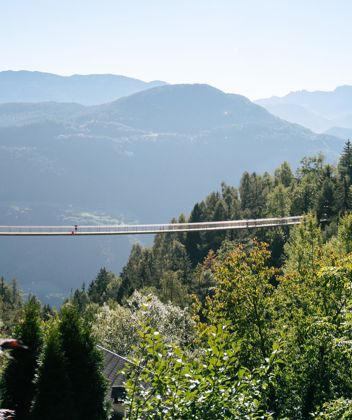
    • Panoramic bridge in Barbian
     These suggestions were generated by our system
    Status
    Open
    Difficulty
    moderate
    Overall difficulty
    moderate

    Derived from the technical difficulty and the stamina requirements.

    Distance
    8.8 km
    Duration
    3:30 h
    Ascent
    565 m
    Descent
    565 m
    Highest point
    1,353 m
    Lowest point
    832 m

    Weather at the starting point

    10-day forecast

    Statistics

    • Content
    • Show images Hide images
    Features
    Maps and trails
    Nothing selected - click and drag in the elevation profile to zoom
    Distance
    Duration
    Ascent
    Descent
    Elevation profile
    Dreikirchen