Holiday planning
Dachmarke Suedtirol
Holiday planning
telephone-white Call us email-white Write us whatsapp-white WhatsApp arrow-white 360° View
Latzfons Cross

Latzfons Cross

Highest pilgrimage place in Europe

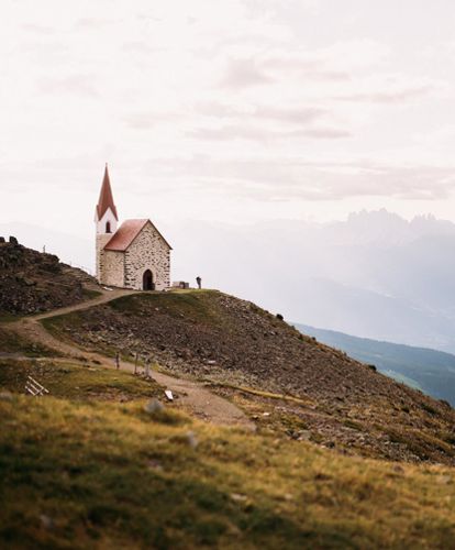
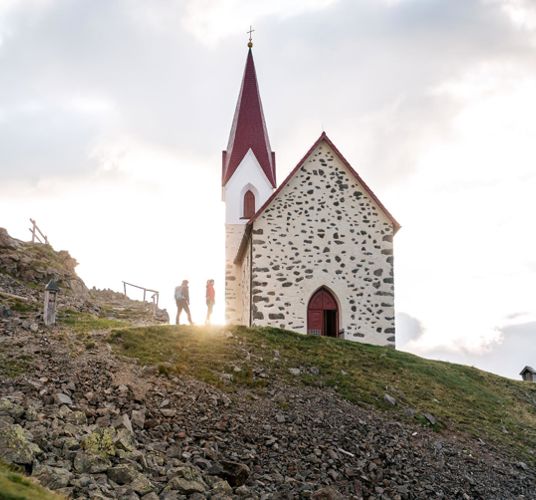
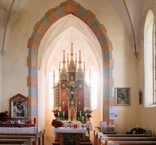
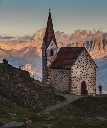
The first rituals held at this site, where the little church has overlooked its wonderful view since 1743, probably date back to prehistoric times, although we cannot be sure of when exactly it was that people began to discover the unique aura of this place.

One thing is for sure: the road to the Latzfons Cross (2,311m), highest pilgrimage site in South Tyrol and erected on the south face of the Kassian Peak, is the oldest pilgrimage trail in South Tyrol.

The mountain refuge hut, close to the church at an elevation of 2,305m, has provided countless pilgrims and hikers with refuge and sanctuary over the years. Innumerable wonderful tales have been told about this sacred place, such as the legend of the “Black Christ” who, with a nod of his head, decided on the spot where the crucifix should be erected. Prayers sent up from here at the end of the pilgrimage, about an hour’s walk up a fairly steep road from the Klausen hut to the cross, afford protection to one and all, particularly from the wrath of the elements.

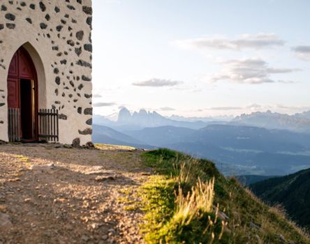
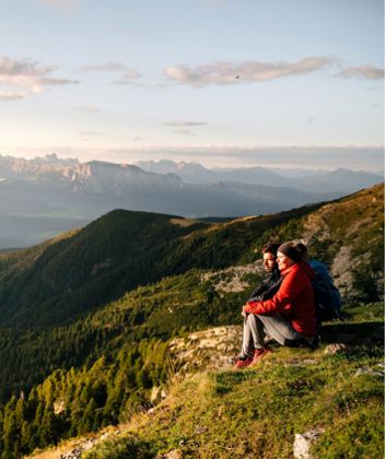
The view stretches over to the Langkofel, the Grohmann Peak, the Kesselkogel and the Rosengarten. It is not just the view that makes this place special though, but the atmosphere which pervades the site and can be felt instinctively by all those who come here.
Not only the view, but also the atmosphere make the Latzfons Cross a magical place!
Hiking trail

Kaseregg-Rifugio S. Croce di Lazfons

Hiking trail · Eisacktal
Responsible for this content
Klausen, Barbian, Villanders, Feldthurns
  • Latzfons Cross Church
    Latzfons Cross Church
    Photo: Tobias Kaser Photography, Klausen, Barbian, Villanders, Feldthurns
Map / Kaseregg-Rifugio S. Croce di Lazfons
Hint

Explanation

Selected alternatives for you
    difficult
    Distance 3.7 km
    1:30 h
    430 m
    83 m
    2,341 m
    1,960 m
    From the parking Kasergg follow the trail No. 15,  after Jochalm take the right way and keep the marker 15B to the "Stange". Here you turn left and follow the marking 15A and then the trail No. 1 to Latzfonser Kreuz.
    Difficulty
    difficult
    Overall difficulty
    difficult

    Derived from the technical difficulty and the stamina requirements.

    Experience
    Landscape
    Highest point
    2,341 m
    Lowest point
    1,960 m
    Best time of year
    Jan
    Feb
    Mar
    Apr
    May
    Jun
    Jul
    Aug
    Sep
    Oct
    Nov
    Dec

    Track types

    Show elevation profile

    Rest stops

    Restaurant Käserei Weinstube Jochalm
    Rest stop
    Tip
    Nearby
    Top Partner
    Waypoint
    Start point
    End point
    Low point
    High point
    Forecast
    Photo
    Video

    Public transport

    In summer, our hiking bus takes you to the most beautiful hiking areas in the heart of South Tyrol. Enjoy the untouched nature on the Villanderer, Latzfonser, Feldthurner and Barbianer Alm/Rittner Horn.

    05.06 - 30.10.2024 (Kühhof from 15.05)
    • every Wednesday
    • 09.00 am: Departure from Lazfons (accessible by public transport - see below)
    • 16.30 hrs: return journey from Kaseregg or Kühhof

    Prices
    • 4.00 € Kühhof (fare for one trip)
    • 4.50 € Kaseregg (fare for one ride)
    • free of charge with the Guest Pass 

    Bus to Lazfons: 
    • 343: Klausen (08.32 am) - Feldthurns (08.47 am) /change/ 342: Feldthurns (08.47 am) - Lazfons (08.58 am)
    Bus from Lazfons: 
    • 342: Lazfons (16.58) - Feldthurns (17.08) /change/ 343: Feldthurns (17.08) - Klausen (17.23)

    www.altoadigemobilita.info


    07.06 - 01.11.2024
    • every Friday
    • 8:30 am: Departure from Klausen (boarding possible at 8:40 am in Feldthurns)
    • 16:30: return journey from Kaseregg or Kühhof

    Prices
    • 7.00 € Kühhof (fare for one trip)
    • 7,50 € Kaseregg (fare for one ride)
    • free of charge with the South Tyrol Guest Card

    Registration required until the day before!
    Tourist Info Klausen (+39 0472 847 424) or at your accommodation (until 6 pm)

    Directions

    On the main road shortly direction Klausen (200m) then right uphill on Feldthurns after Latzfons. After Latzfons right up the signs "Parking Jochalm-Kaseregg"

    Coordinates

    DD
    46.675918, 11.499754
    DMS
    46°40'33.3"N 11°29'59.1"E
    UTM
    32T 691187 5172186
    w3w 
    ///boxed.stroke.bench
    Get there by train, car, bike, or on foot!

    Similar routes nearby

    • On the Latzfons Alm to the Stöfflhütte hut
    • Kaseregg - Saltner Hütte – Stöfflhütte – Kaseregg
    • Overlook “Gamp”
    • trail "mountain pine"
    • Gasserhütte-Marzuner Alm-Stöfflhütte
     These suggestions were generated by our system
    Difficulty
    difficult
    Overall difficulty
    difficult

    Derived from the technical difficulty and the stamina requirements.

    Distance
    3.7 km
    Duration
    1:30 h
    Ascent
    430 m
    Descent
    83 m
    Highest point
    2,341 m
    Lowest point
    1,960 m

    Weather at the route's trailhead

    Statistics

    • Content
    • Show images Hide images
    Features
    Maps and trails
    Nothing selected - click and drag in the elevation profile to zoom
    Distance
    Duration
    Ascent
    Descent
    Elevation profile