Chestnut Trail | Stage 4
From Barbian to Bolzano
This stage of the route is very long, so it can be divided into several parts.
Route length: 33.9 km
Metres in altitude ascent: 934 m
Metres of descent: 1,498 m
Average walking time: 11:15 h
Route:
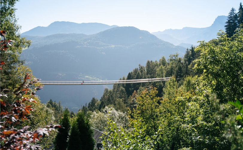
From the village centre of Barbian, the Chestnut Trail follows the asphalt road for a bit in the direction of Saubach. After about 10 minutes, you reach the new 120 m long bridge that crosses the deeply cut valley of the Ganderbachgraben.
From the bridge you experience a magnificent view of the waterfall and the walls of the Saubach Kofel. On the orographic right bank of the Gonderbach, follow the asphalted road to the beautifully situated hamlet of Saubach (800 m, Saubacher Hof inn). Continuing along the road, we come to the farms Bischof and Penn, branching off to the left there, the route leads along a field path below the road (the signposted access from Kollmann leads up here). Shortly before the Diktelegraben, the path re-joins the road. After the bridge, directly on the municipal border to Ritten, you reach a shady rocky area and hike along the road until you reach the Rotwand farms.
Note: A transfer of the "Keschtnweg" from the asphalt road to a car-free hiking trail is being planned (as of April 2021).
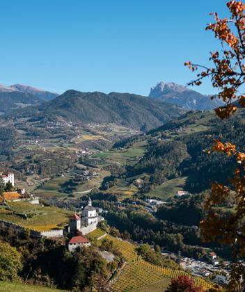
The hike continues along the road in the direction of Lengstein. At the pond turn left into the farm entrance of the Pirchnerhof farm and after a few metres turn right onto the hiking trail. A short ascent, past the well-marked "Schalensteinen" stones, leads to the Church of St. Verena in Ritten (889 m). Following the Cross Trail, you hike down an atmospheric path to the Penzl farm (beautiful boutique B&B Penzl9).
After the Penzl farm, follow the road for a short distance to Braun and turn left onto the farm road, at the next farm downhill to Weidacher and on a field path to Gasthof Zuner (790 m, St. Andrew's Church on the nearby hill). This is where the trail from Atzwang leads up. An equally signposted trail connects here from Lengstein down.
After a short ascent on the Street Höfestraße, we follow a field path again at Schmalzer Hof (left) to Steidacher Hof in the hamlet of Antlas (810 m). The Chestnut Trail leads here on the Höfestraße south side around the mountain ridge to the Finsterbachgraben. The ascent now overcomes a slope slightly above a field path until you reach Frankner Hof farm (898 m), below Lengstein. Here the road leads downhill to the Köblbachgraben, after the house by the stream you overcome the counter ascent on a field path until you reach the Vigl Hof farm. Now the Chestnut Trail leads downhill and uphill again and again through the Finsterbachgraben and at the Joggum farm via a forest path slightly uphill to the Schmaleich farm (950 m). Now follow the downhill farm road through the forest, past the "Atzwanger Aussicht" (wonderful view) and hike in switchbacks to the Rieserhof farm. A field path runs through the Siffianer Graben to the Niederstätter and on the road briefly downhill to the Höfegruppe in the Siffianer Leitach (826m, accommodation options). Here the signposted climb from Steg joins the Chestnut Trail.
Below Siffian, the trail leads downhill to the right on a paved field path to the Rielingerhof (stop for refreshments/overnight stay). You hike directly past the beautiful wine farm and cross the forest above the Stein castle ruins and then the Rösslerbachgraben (760 m). The counter-ascent leads across the shady slope to the fields
near Tasenegger and to the chestnut grove above these fields. Soon you reach the farmsteads of Melterer and Blümler and soon cross the Gasterer Graben, where the Earth Pyramids of Unterinn rise from the earth.
After a rest at this Rittner sight, you reach the orchards of Hinterhuber Hof farm and follow the slightly ascending Höfestraße, which shortly afterwards leads into the “Dorfstraße”, which leads into the village centre (refreshments/accommodation).
At the parish church of St. Lucia (910 m), follow the Dorfgasse to the bus stop on the Main Street of Ritten. Cross the car park and walk past the farms of the hamlet of Eschenbach until you reach the Sulzner farm (market garden).
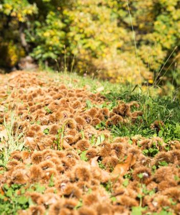
Walk through the forest over a rocky step and reach the Partschuner farm (996 m). From there, take the asphalted farm access road and descend in two bends to Signat (848 m). After crossing the road in the small village centre of Signat (church and inn), you hike on a slight incline to the end of the access road at Pieracher Hof farm. Now the trail leads to the lower edge of the meadow and then into a steeper stage of forest down into the sloping terrain to the Rivelaunbach stream in the Katzenbachgraben (745 m). After crossing the stream (an abandoned farm used to stand here), you hike past beautiful chestnut trees until the Keschtnweg trail joins a forest road (to the right you can hike to Oberbozen - Rittner cable car mountain station).
Stay left and follow the access road to the Spornbergerhof farm (871 m), which is situated freely on a hilltop. After passing the Spornberger farm, the steep, partly concrete road towards Bozen begins. After about 600 m, the trail branches off to the right at an old viaduct of the abandoned Rittner cogwheel railway and continues moderately steeply, after a crossing with a farm road, again to the right along a trail to the Ebnicherhof farm (832 m, stop for refreshments). From the Ebnicherhof farm, walk along the slightly ascending access road to the right in a westerly direction until you turn left after about 550 m (marked 2 A). Now the descent into the Bozen valley basin begins, which leads along the beautiful, sun-exposed and partly paved footpath to above the "Peter Ploner" farmhouse and further down to a distinctive bend.
Directly at the bend, follow the wide path to the right and, after a flat stretch, reach a water reservoir above the vineyards of St. Peter (junction with path no. 3 - Nesslbrunnsteig). Stay on the wide path and hike straight ahead until the path meets the asphalt castle driveway via a few road bends. Stay to the right and hike about 300 m past beautiful vineyards until you reach Runkelstein Castle.
From Runkelstein Castle, you now descend the paved footpath to the valley road/bus stop and cycle path.


