Chestnut Trail | Stage 5
From Bolzano to Terlan/Vilpian
Distance: 27.5 km
Metres in altitude ascent: 1,446 m
Metres in altitude descent: 1,511 m
Average walking time: 9.40 hours
Route:
From the car park/bus stop below Runkelstein Castle (300 m above sea level), hike over a bridge and turn left, past allotment gardens, until you reach the valley station of the Jenesien cable car (currently closed for renovation work. January 2021).
The hiking trail (marked with no. 2) leads very steeply over the access road to the Rafenstein castle ruins, past the former Kellermann inn to the Sandner Hof farm and after about 80 m you turn into hiking trail no. 1 B. This leads for a short distance through a wooded area. This leads a short distance through a mixed forest to a striking earth pyramid, which can be seen very well on this trail. The trail leads into the steep farm entrance above the little church of St. Jakob im Sand (500 m NN) to the Oberpardatscher Hof, which is located below the beautiful chestnut trees on trail no. 1 A.
Hiking trail 1 A now leads moderately steeply past the Prötsch farm to the Anich farm (600 m) above St. Georgen. Follow the narrow farm access road to the right and cross the small Saltenbach stream in a bend. You now walk past a farm, after about 100 m the hiking trail (5 A) branches off to the left in the direction of Fagenbach and runs through a mixed forest below the country road to Jenesien to the Winterle farm. Now follow trail no. 5, cross the main road (LS 99) at a bus stop and climb a short, steeper section to the Glaninger Straße road and, after the tunnel portal, hike in the direction of Trattner Hof (inn). The hiking trail (no. 5) now runs partly on or parallel to the little-used road to the junction with hiking trail no. 9, which then lead together to Werner-Hof (accommodation) in Glaning.
In a few minutes you reach the little church of St. Martin in Glaning with the Messnerhof (inn) and the beautiful chestnut trees.
From Glaning, you now hike along the narrow and little-used country road (LS 171) in a westerly direction. After about 800 m, turn right (trail no. 11), cross the Mauritiusbach stream there and descend from there back onto the asphalt road.
Excursion to the ruins of Greifenstein Castle/Sauschloss:
From the country road, hike along trail no. 11 to Noafer (stop for refreshments/overnight stay) and on to the legendary Greifenstein ruins, popularly known as the "Sauschloss".
(Distance 2.5 km, 130 metres of ascent and descent).
Above Noafer, follow trail no. 9 to Schmalzhof and follow the trail to the left into the beautiful beech forest that runs below the asphalt road. After a slightly longer and another short climb, you reach the main road again (at km 5). Follow this slightly uphill for a short distance and you reach the farmstead "Moar in Rumsein".
At "Moar in Rumsein", stay on trail no. 9 and hike on a slight incline for about 200 m across the meadows until you reach a wooded area. Here, always following the asphalted farm access road, turn right and climb over a few hairpin bends to a bridge that crosses the Margarethenbach stream. The narrow road winds over a few hairpin bends, past beautiful chestnut trees, to the Lanzoner Hof farm. To the left of the farmstead, follow the slightly ascending road for about 500 m until you reach the Wegscheider farm.
The trail leads through the farmstead and then climbs to the right until you reach a fenced pond/water reservoir. After a short climb, a steep trail now leads down to the left (signposted "Terlan") and joins a wide path on the right below the Grunerwand. Now follow trail no. 8 B in the direction of Verschneid until you reach the "Bergjosl" inn.
From the "Bergjosl", descend to the left above the old "animal cemetery" on trail no. 4 A, (Legar) in a westerly direction until you reach a water reservoir and the country road to Mölten.
Note: Those who do not want to descend to Terlan can choose trail no. 4 A here in a westerly direction to "Ober-Tschirggl", which then continues to Vilpian.
Now begin the descent to Terlan via the Oberlegar wine tavern to Unterlegar, where you briefly follow the Möltnerstraße road to the left and continue to the right along hiking trail no. 4 to Klaus in der Mühle. Past the Liebeneich estate of the Counts of Enzenberg, the trail continues left to the Köstenholz estate and across the vineyards to the centre of Terlan at the "Maria Himmelfahrt" parish church.
The last section of the "Keschtnweg" now leads from the centre of Terlan to Vilpian.
From the Terlan parish church, follow the Kirchgasse on the right and turn left onto the Silberleitenweg, which is also marked as hiking trail no. 4 A, past the public outdoor swimming pool to the old tunnels of the Silberleiten silver mine.
Quite quickly you overcome the difference in altitude through the sun-exposed slopes and then look out for trail marker no. 1 A, which continues to the left in a westerly direction (trail no. 4 A branches off to the right and leads to Oberlegar).
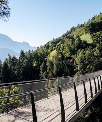
You now walk along the scenic road from Vorberg to Ober-Planatsch and reach a beautiful chestnut grove above the spectacular bridge that spans the Vilpianerbach stream and over which you reach the Scholer Hof farm (refreshment stop).
From Scholer Hof, follow trail no. 1 A for a short distance and turn left onto trail no. 1. This leads over a few hairpin bends to a fork in the road (resting bench), where you can take the steep descent to the left (only for experienced walkers) down to the provincial fire brigade school or the comfortable trail no. 1 to the cable car valley station in Vilpian. Both paths take you to the centre of Vilpian, where there are several places to stop for refreshments and accommodation. Vilpian is also well connected to the public transport network by the SASA line Bolzano-Merano and the Merano-Bolzano train line.
The Keschtnweg trail ends here.


